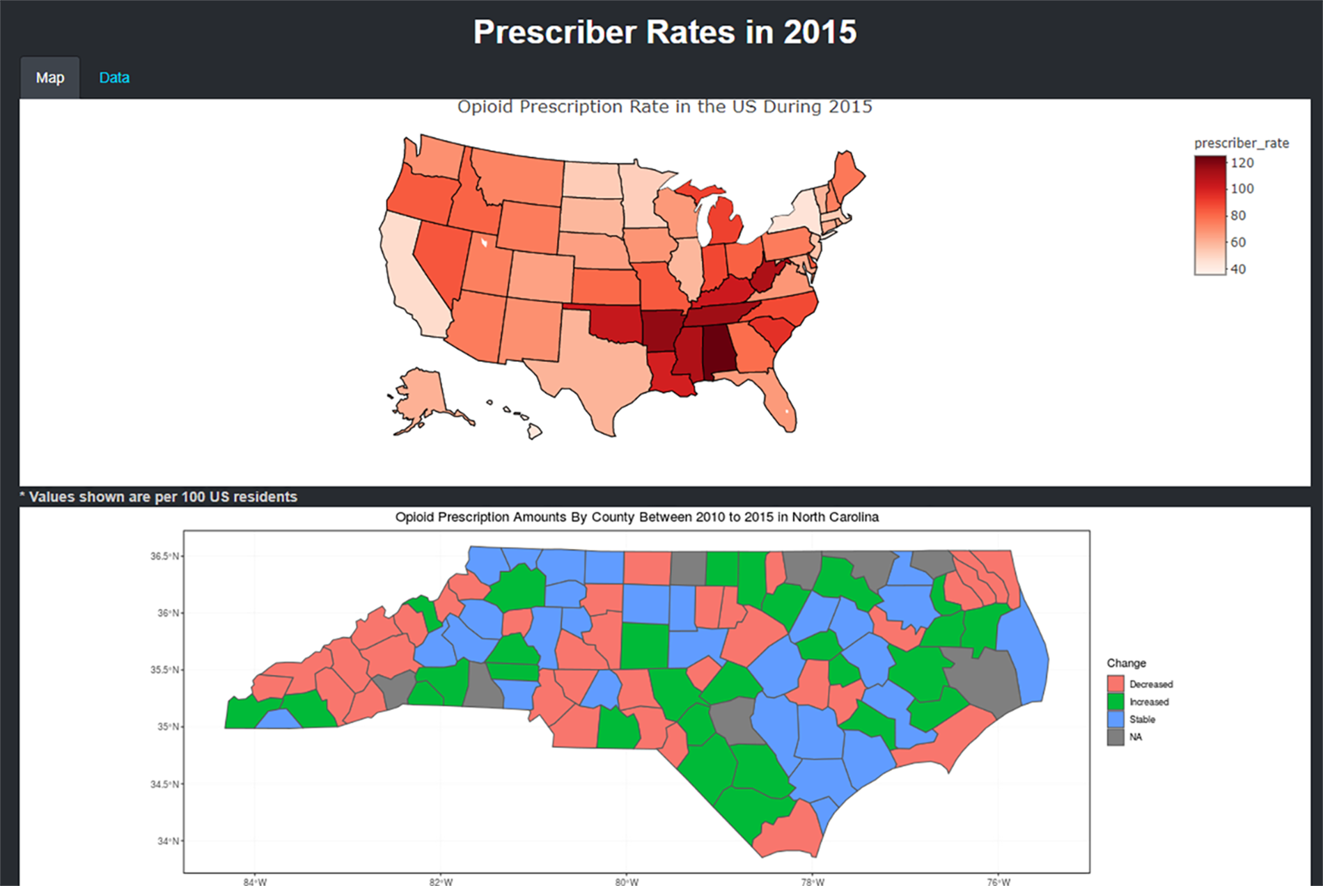
Opioid Visualization
Studying Opioid Addiction in the United States.
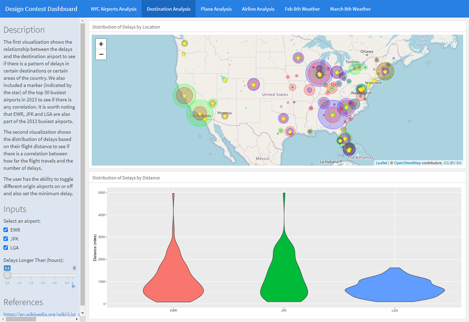
NYC Airports Visualization
Studying NYC Airports in 2013.
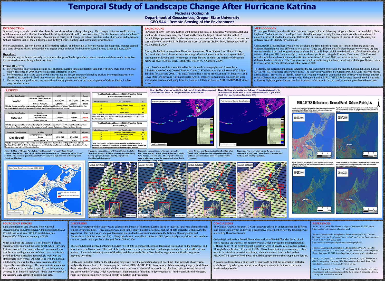
Hurricane Katrina GIS Analysis
Temporal Landscape Change After Hurricane Katrina.
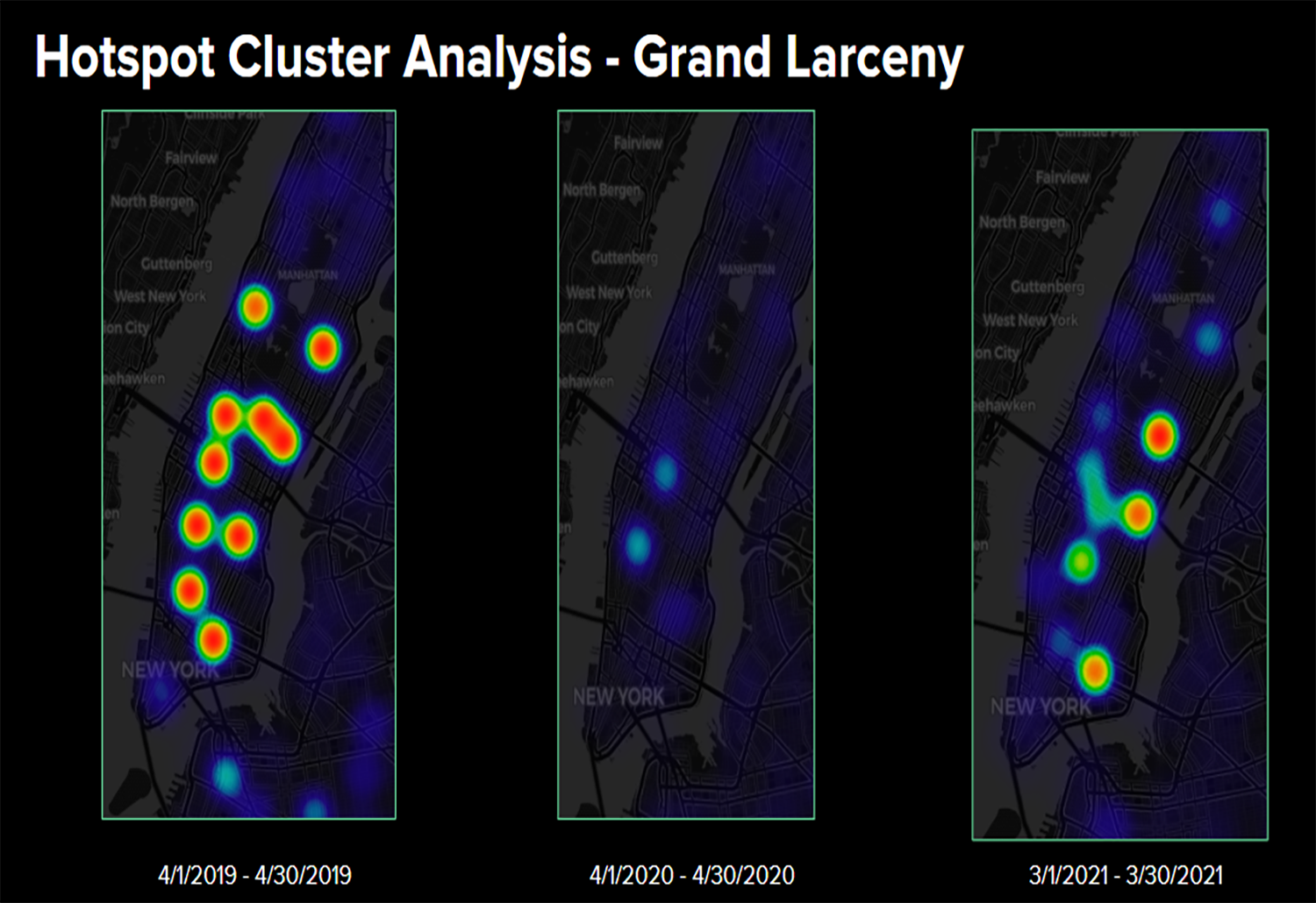
NYC Complaint Network Analysis
Network Analysis of Complaints from 2019 to 2021.

Analyzing Twitter Data from Popeyes
Tweets about the Popeyes chicken sandwich craze.
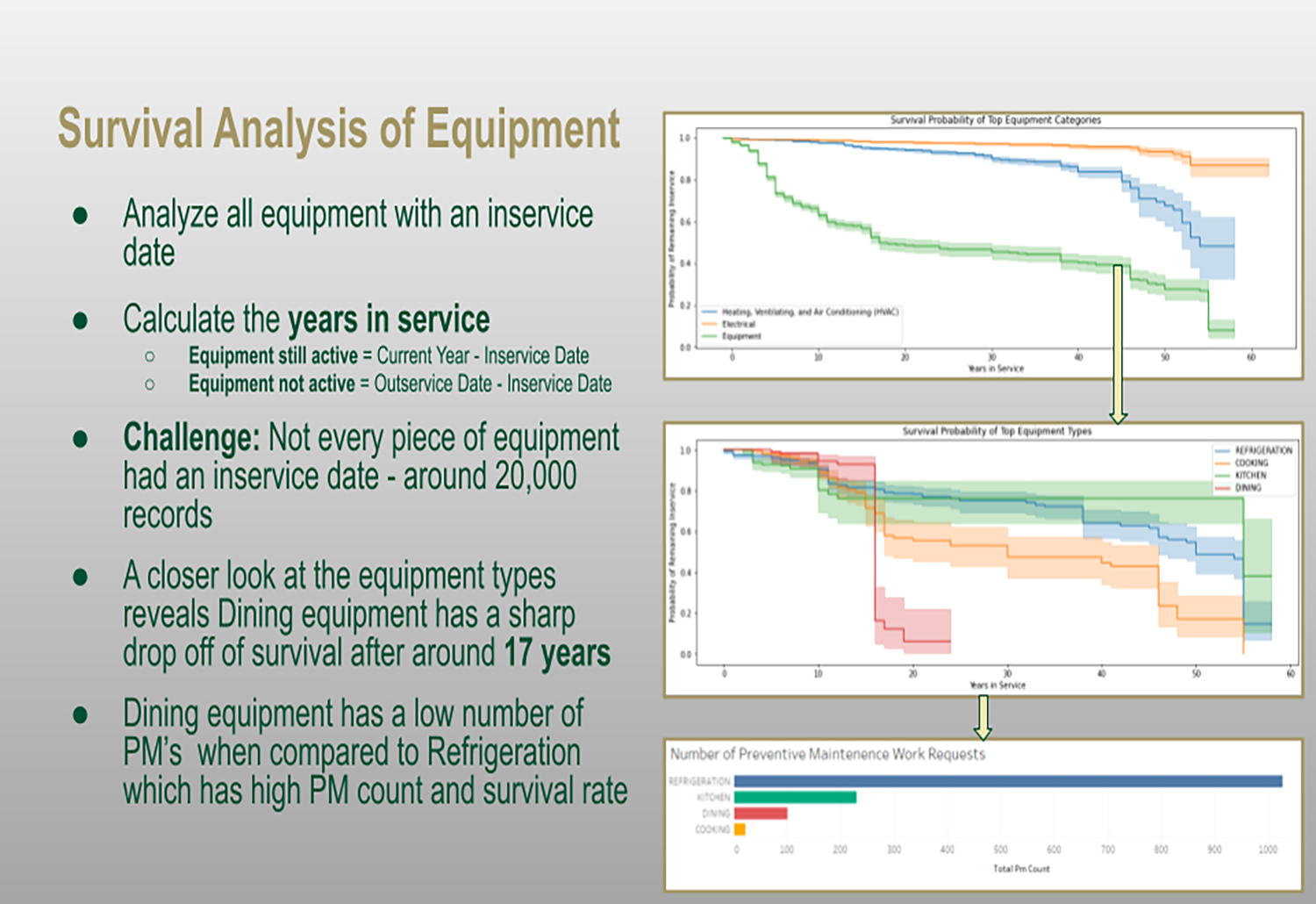
UNC Charlotte Data Science Internship
Using machine learning on work request data.
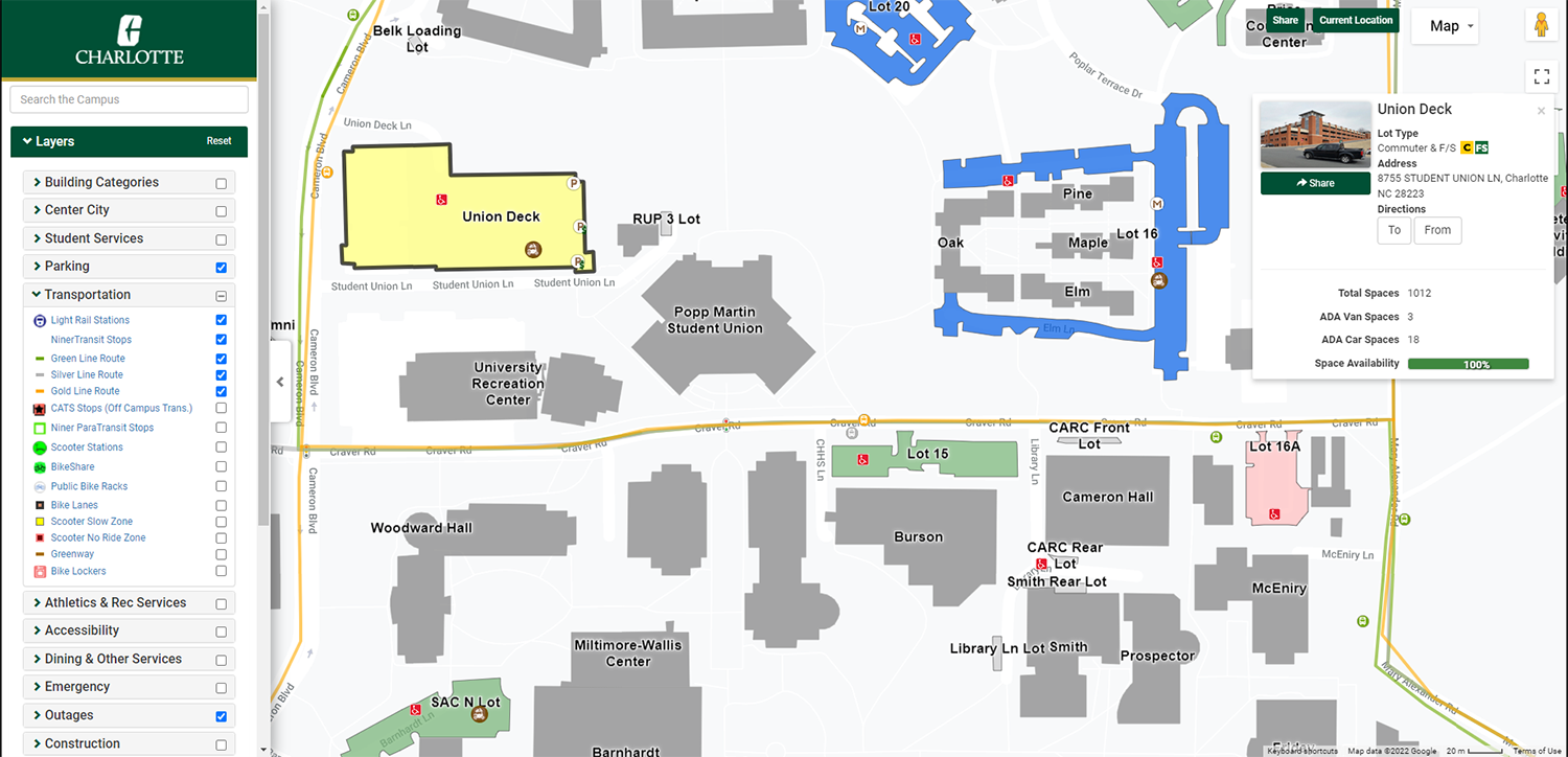
UNC Charlotte Campus Map
UNC Charlotte Campus Map Project
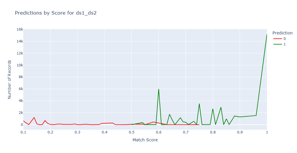
Entity Resolution Process
Using record linkage to identify people across datasets using their names and birth dates.
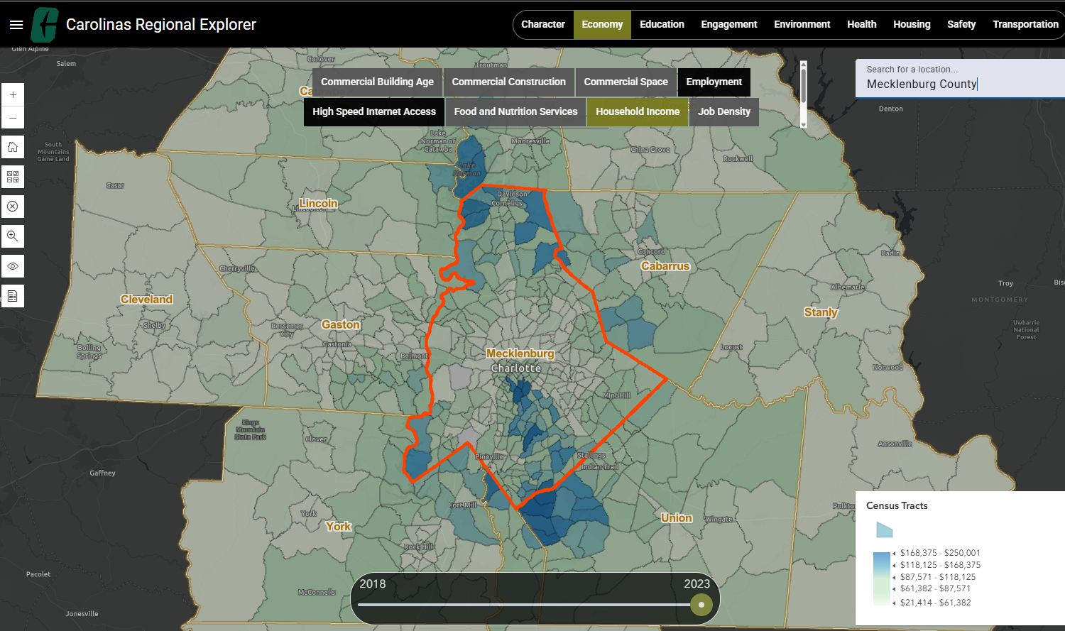
Regional Explorer Web Map
Web mapping application to explore relationships and patterns over time covering categories such a demographics, economy and education variables in the Carolinas.
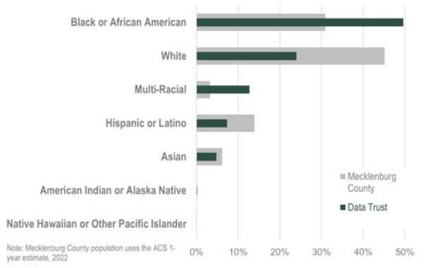
State of Our Data Report
Report equipping changemakers with trusted data and insights to transform the Urban Institute's 14-county region.